maps
created using sources referenced in my research
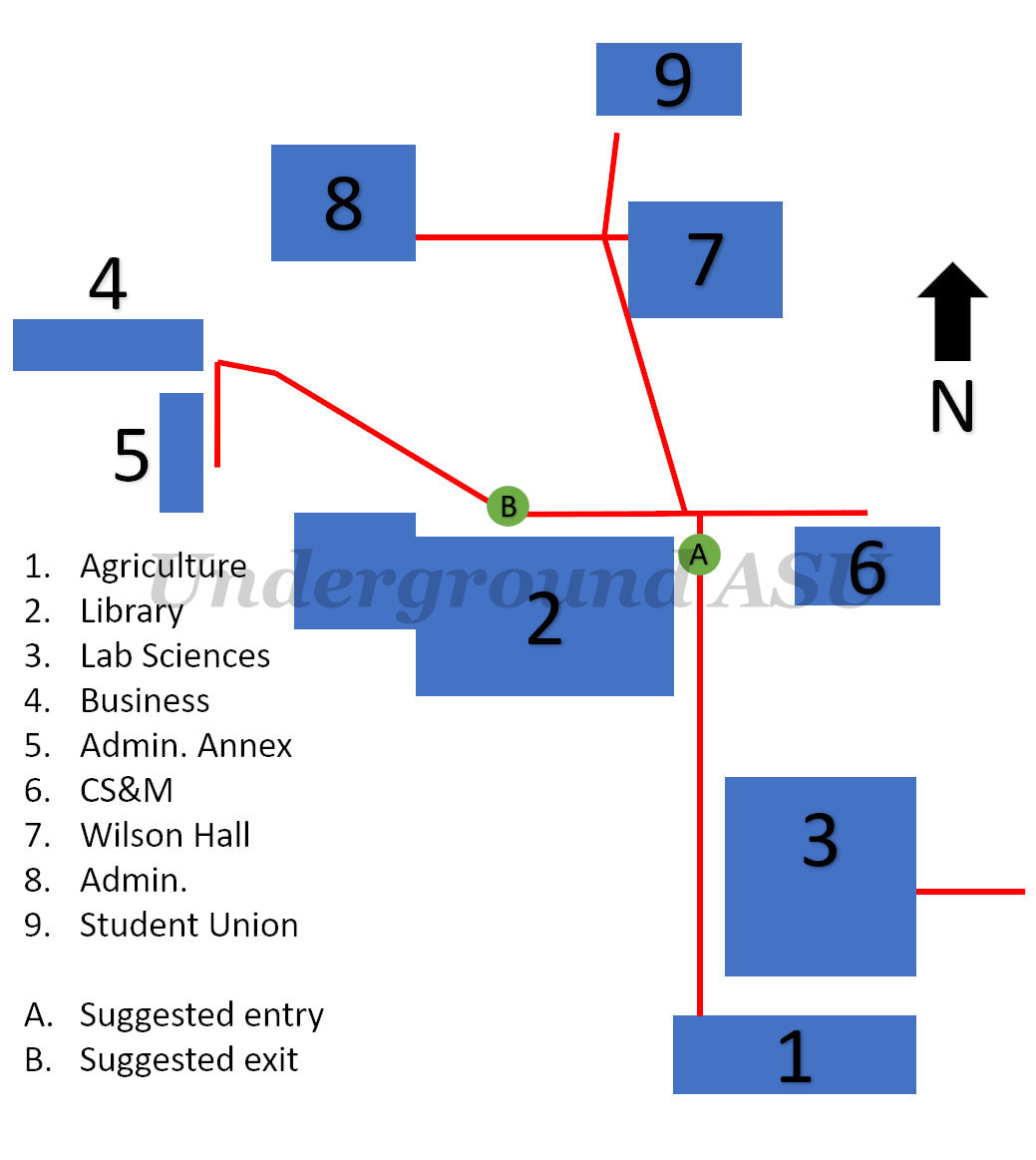
approximate paths of the operating, in-use tunnels on campus (red), as indicated by the University's utilities infrastructure map (Campus Utilities, 2018)
|
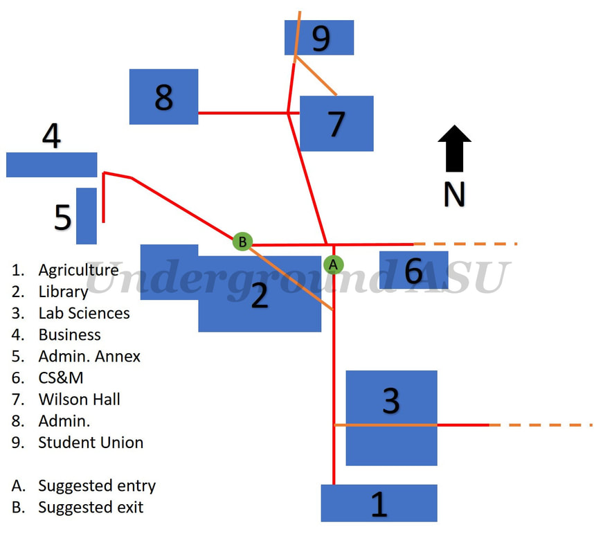
approximate paths of the operating tunnels on campus (red), as well as defunct or demolished tunnels (orange), and possible tunnel sections (dashed orange); not shown is the known-demolished portion extending north from the Student Union
|
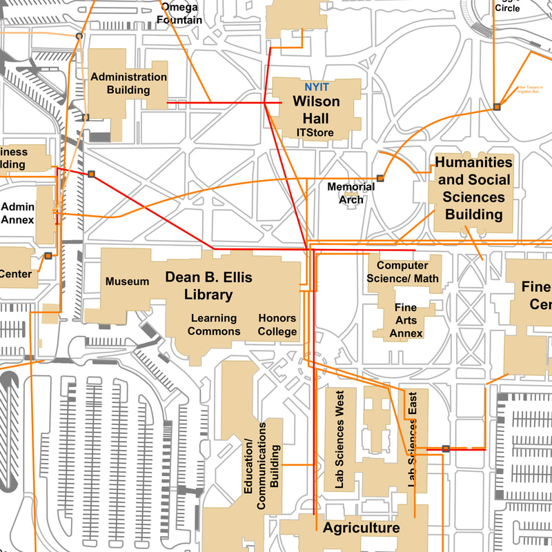
utility map published by ASU, cropped to focus on active tunnels, shown in red (called "ITS Tunnels" on the full-size map)
(Campus Utilities, 2018)
(Campus Utilities, 2018)